Editing
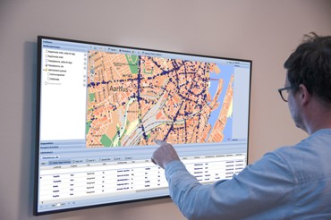
In KortInfo, you have the option of updating geographical data directly in your map via advanced editing in one unified structure.
KortInfo Editering allows you to create and maintain geographic data. When the data basis is the same for all users, it becomes possible for data to be edited and maintained in a uniform and efficient manner.
Users, who can for example be citizens or employees in municipalities and utilities, can edit directly in the map or through WFST via GIS systems. The configuration in KortInfo can ensure that data is validated and that attributes are added according to a defined list. Users can also add history to their edits.
Multi-user editing increases efficiency
KortInfo's user management provides the opportunity to differentiate users' rights to make changes in the various layers and associated data. This is how your organisation gets more efficient projects with true multi-user editing, where several users can work on the same theme at the same time but without disturbing each other's data.
KortInfo Editering can also be integrated with several different data sources such as Plandata.dk, Danmarks Arealinformationen and the FKG Geodatabase.
Get in touch or get a demo?


